Enjoyed another wonderful Public Transportation hike this weekend. We caught a BART down to the Daily City station and then caught the SamTrans 110 bus down to Pacifica. The connections went well there and back, but be aware the 110 runs once every 1.5 hours. But don't let that spook you. This hike was refreshing, interesting, and totally worth the time.
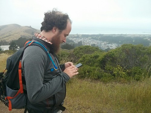
We started off by heading up the Sweeny Ridge Trail. Finding it from the bus stop was easy enough. The first 1.2 miles was some steady incline, but since we were in Pacifica we were blanketed in fog the entire time and never once got too warm. It's questionable if we ever were really warm at any point during the trip. There was definitely apprehension as we watched the fog out the bus windows during the approach. We've had some disastrous hikes in the past... thankfully Adam convinced me to wear not just a thermal top for the hike but also my thermal leggings under my skirt. It would have not hurt to have brought another layer... and a hat... and my own gloves (I wound up stealing Adam's)
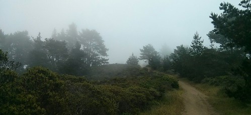
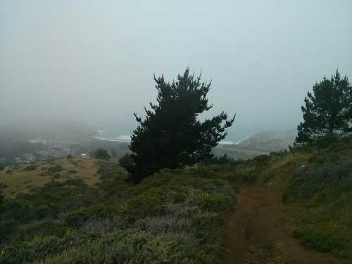
Have you seen the movie Stalker? It's a terrible film, don't bother if you haven't, but there is some striking imagery in it of foggy landscapes. That's what this hike looked like. We were quickly swallowed up by fog and the world stopped existing beyond the small spot we occupied. The trail was a constant surprise because it twisted into trees or behind shrubs and then out of existence. Sounds were muted, everything was covered in dew, and Adam's hair and beard quickly got soaked. (My braid was too dense we think to hold the dew). At one point we were wearing sunglasses to keep the fog from our eyes and had to repeatedly take them off to wipe clean.
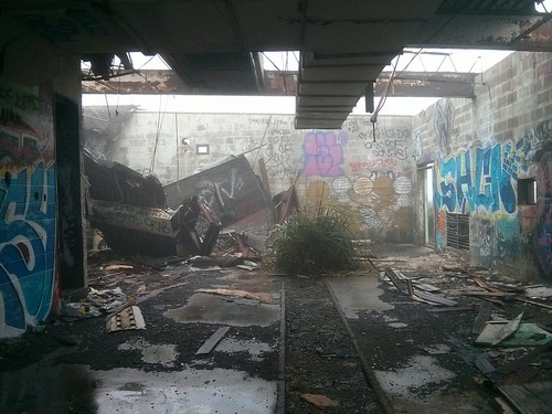
We eventually stumbled across a Nike missile site that had been abandoned.
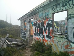
The site was at the peak of the hill we think- there was wind there at least. But still fog. After that we started to decent and eventually could see the coast. A little. Here the trail gets a little iffy. In theory there's a much more leg-friendly trail down to the church by the freeway... but we got turned around and took the mountain biker path. Insanely steep trails, loose rock, poor footing. Luckily it didn't last too long.
Popping out onto Highway 1 again, next to the church, we were DELIGHTED to see Lovey's Tea Shoppe right there, across the road! That's not a typo-- while it is related to (and shares the exact same menu with) SF's Lovejoy's, its name is Lovey's. Adam and I were able to slip into the communal table no problem and had us a pair High Teas.

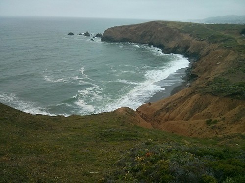
Given that the bus comes once every 1.5 hours we had "just" missed one by 15 minutes, and the Colma BART bound 112 wasn't any more convenient. That's fine, there was still the final portion of the hike-- Mori Point. It winds right along the coast cliff and was absolutely bursting with wildflowers. An excellent way to wind down a hike and aid in a little digestion.
All in all, an excellent hike and an excellent lunch. GMap-Pedometer puts it at an easy 7.1 miles. Check out the link for the exact route taken. Google Maps doesn't quite let us capture it (it refuses to acknowledge the path down to the highway) so here's the first portion & the second portion.
Looking forward to trying it again (perhaps following Sweeny Ridge trail a bit further)